When the flood hit Keningau: why precise location saves lives
During the 2021 Keningau floods, phone towers went down. Victims could not share GPS links. A simple code could have changed everything.
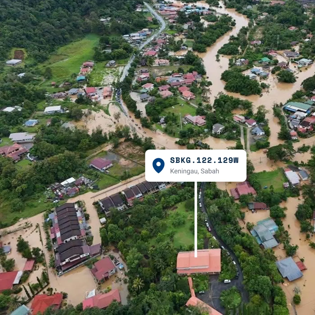
When Sungai Pegalan burst its banks in January 2021, the water did not wait for anyone to finish a sentence. Roads disappeared first, then power, then the places people used as landmarks. By the time the calls reached responders, the map of the area had already changed. What had been "behind the shop" in the morning might be underwater by the afternoon, and what had been a road could become a brown line of current that no vehicle could cross.
One caller said they were behind the sundry shop. Another said the bridge was still visible from the field. In a flood, those details break apart fast. A family might know exactly where they are and still struggle to explain it clearly enough for a team that is driving in from somewhere else. That gap between knowing and communicating is where minutes are lost.
The offline problem
GPS coordinates still work on a phone, but they are fragile in a rushed call. One wrong digit sends the team to the wrong bend of the river. One lost signal means the location never gets shared at all. In emergency work, the smallest mistake becomes a long drive in the wrong direction.
KodLokasi codes like SBKG.122.128W are: - Short - 13 characters instead of 20+ for GPS - Readable - easy to spell over phone - Self-locating - SB = Sabah, KG = Keningau - Offline - generated on-device with no internet
That matters because responders are usually moving before they have perfect information. A code gives them a district, a grid square, and a common language for dispatch. The caller can speak once, the responder can move once, and the team can spend the rest of the time helping instead of guessing. In a flood, that is the difference between moving now and asking one more question.
After the water drops, the same code still helps. Clean-up crews need to know which house to revisit, where the debris started, and which crossing was damaged first. A district office can log the report once and hand it to the next team without rewriting the whole story from memory.
That is what makes the code useful after the sirens stop. It does not only get responders to the right place. It keeps the place easy to describe for repairs, follow-up visits, and the next round of bad weather.
Where to go next
If this article matches the location problem you are dealing with, continue to the pages that explain the product, the feature set, and the proof behind it.