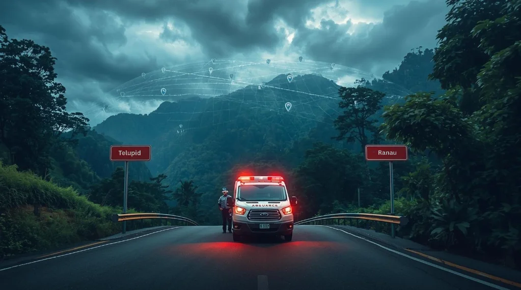
Ongoing Challenge · Telupid and Ranau Districts, Sabah
Telupid-Ranau Ambulance Dilemma
Turning boundary confusion into one clear dispatch reference
Executive Summary
The road between Telupid and Ranau passes through rural stretches where callers may not know which district they are in. In a medical emergency, that uncertainty can slow the first dispatch conversation: the operator still has to confirm the incident point, the nearest available team, the usable access route, and the correct receiving facility.
KodLokasi does not replace ambulance procedures. It gives the call a shared starting reference: Sabah, the relevant district, and a precise 10 m grid cell. That makes the handoff clearer from caller to dispatcher to field team, especially near administrative boundaries.
The Crisis: Boundary Ambiguity
Districts Involved
2
Telupid & Ranau
Key Challenge
Boundary
Which side?
Response Need
Clear Point
Shared reference
Timeline of Events
Incident Occurs
A crash or critical patient is reported along the rural road between Telupid and Ranau
Emergency Call
The caller can describe the road and landmarks, but cannot give a precise district-coded point
Dispatch Check
Operators must confirm district, access route, nearest available ambulance, and receiving facility before the handoff is clean
The Boundary Reference Problem
On rural roads near district edges, familiar directions are not the same as dispatchable location information:
We are somewhere after the Telupid turn-off toward Ranau
It is near the boundary, before the next kampung
We do not know if this is still Telupid or already Ranau
The KodLokasi Solution
Imagine a Different Scenario
A caller at the incident scene opens KodLokasi and sends one code: SBRN.2639.1692E. From that code, dispatch can see Sabah, Ranau, and a 10 m location cell. If another nearby team is better placed to respond, the same code still gives everyone one shared target.
1. District Context
The "SBRN" prefix identifies Sabah and Ranau, so the call begins with administrative context
2. Precise Incident Point
The "2639.1692" grid reference points to a specific 10 m x 10 m cell, not a broad road segment
3. Cleaner Dispatch Decision
Operators can compare the same point against ambulance availability, road access, and facility options
4. Shared Field Handoff
The caller, dispatcher, ambulance crew, and receiving facility can refer to the same code during coordination
Projected Impact with KodLokasi
Without KodLokasi
- ×District boundary guessed from landmarks
- ×Caller repeats road descriptions
- ×Dispatcher spends time confirming the incident side
- ×Teams may work from different reference points
- ×Handoff depends on long verbal directions
With KodLokasi
- ✓State and district visible in the code
- ✓Precise 10 m incident reference
- ✓Nearest-team decision made against one shared point
- ✓Clearer handoff between dispatcher and field team
- ✓Less dependence on landmark-based explanations