August 2025 · Keningau District, Sabah
Keningau Flood Incident 2025
Turning unclear flood reports into usable location information
Executive Summary
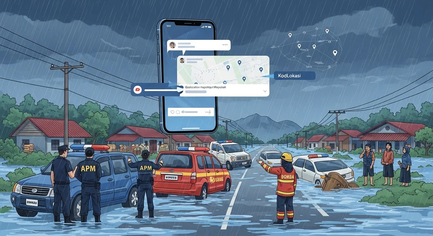
The August 2025 flash flood in Keningau district exposed a practical communication problem. Residents described affected places using landmarks, road names, and local memory. Officials worked with operational references such as CH/KM chainage and road segments. Both sides were trying to describe the same flood, but they were not using the same location language.
This is not a failure of the public or the response team. It is a reference-system gap. A phrase like "near the old market" can make sense to a resident, while "CH 45.2" can make sense to a road or operations team. Under emergency pressure, those descriptions still need to become one clear point on a map.
KodLokasi provides that shared point. A resident can read one short code from the map, and responders can immediately see the state, district, and 10 m location cell behind the report. It does not replace official verification, but it gives everyone a clearer starting point.
The Crisis: Same Flood, Different Location Language
Incident Date
August 2025
Flash flood event
Official Reference
CH/KM
Useful for operations, unclear to many residents
Public Reports
Landmarks
Understandable locally, too broad for dispatch
Timeline of Events
Heavy Rainfall
Torrential rain triggers flash flooding across parts of Keningau district.
Public Reporting
Residents try to report rising water using village names, landmarks, road descriptions, and forwarded messages.
Official Response
Response teams work with CH/KM chainage, road segments, and internal operational references.
Communication Gap
The same place must be translated between local descriptions and technical references before action can be coordinated.
Where the Message Breaks Down
The barrier is not language alone. The barrier is the lack of one shared location reference that residents, responders, and agencies can all act on immediately.
CH 45.2 or KM 46.0 may be useful to an operations team, but many residents will not know where that segment begins or ends.
Near the old market by the main road may help locals, but it is too broad for dispatch, evacuation routing, or damage mapping.
A map link or WhatsApp pin can fail when mobile data is weak, when the sender moves, or when the message is forwarded without context.
How KodLokasi Changes the Story
Imagine a Different Scenario
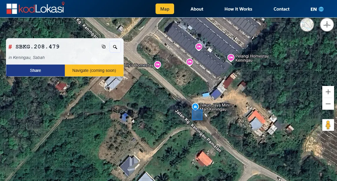
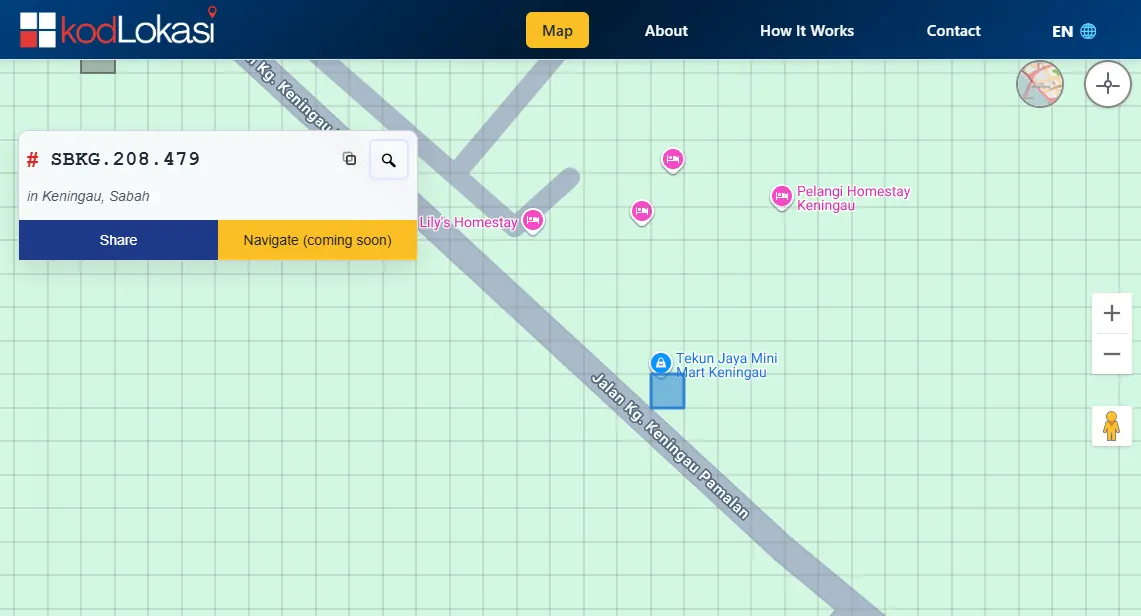
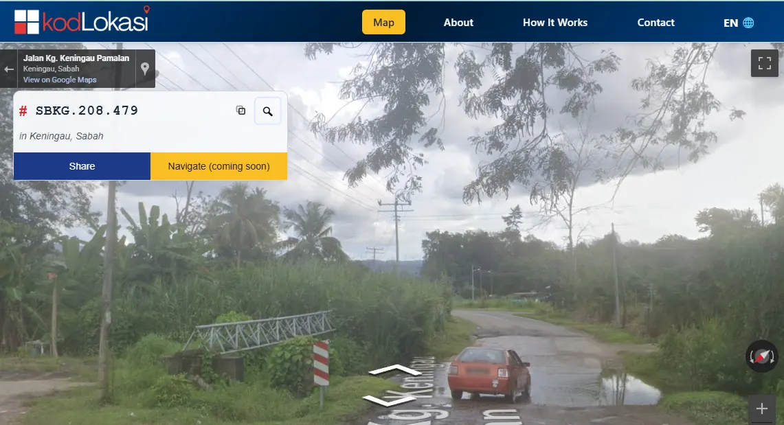
A resident sees floodwater rising, opens the KodLokasi map, and reads one code:SBKG.208.479. From that code, responders can immediately see Sabah, Keningau, and a 10 m location cell. The resident can send it by SMS, post it in a community group, or read it aloud during a call.
1. Simple for Residents
Residents do not need to explain chainage, coordinates, or long directions. They copy or say the code shown on the map.
2. Useful for Responders
The code carries administrative context and points to a 10 m location cell, giving teams a clearer place to verify and act on.
3. One Shared Reference
Residents, local coordinators, and agencies can refer to the same location without translating landmarks into technical references first.
4. Faster Coordination
Flood reports, evacuation routing, aid drops, and damage assessment can be grouped around precise, repeatable locations.
Projected Impact with KodLokasi
Without KodLokasi
- ×Residents and officials use different location references
- ×Landmark-based reports need manual interpretation
- ×Map links depend on data, apps, and message context
- ×Evacuation and aid planning take longer to coordinate
- ×Damage reports are harder to compare across agencies
With KodLokasi
- ✓One code links the public report to a map-ready location
- ✓State and district are visible inside the code
- ✓Reports can be shared by SMS, voice, or social media
- ✓Teams get a clearer starting point for verification
- ✓Flood response data becomes easier to group and compare